NZ citizen science projects are collaborative research initiatives where public volunteers collect data to support New Zealand’s conservation efforts. Participants contribute to biodiversity monitoring through platforms like iNaturalist NZ, the Great Kererū Count, and marine debris surveys, helping scientists track species distribution, pest density, and environmental health across Aotearoa.
The Importance of Citizen Science in Aotearoa
New Zealand’s ecosystem is globally unique, characterized by a high degree of endemism—species found nowhere else on Earth. However, this biodiversity faces significant threats from introduced predators, habitat loss, and climate change. Traditional scientific funding and resources are often limited, making it impossible for professional scientists to monitor every corner of the country’s rugged terrain.
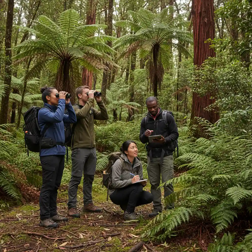
This is where NZ citizen science projects bridge the gap. By engaging the public—locals, students, and eco-tourists—researchers can access a vast network of data collectors. This “crowdsourced” science allows for real-time monitoring of species distribution, early detection of invasive pests, and long-term tracking of environmental trends. Whether you are hiking in the Southern Alps or walking a beach in Northland, your observations can contribute directly to national policy and conservation management strategies.
Using iNaturalist NZ (Mātaki Taiao)
One of the most accessible and impactful ways to get involved is through iNaturalist NZ — Mātaki Taiao. This platform serves as the primary repository for biodiversity data in New Zealand and acts as a social network for nature enthusiasts.
What is iNaturalist NZ?
iNaturalist NZ is a joint initiative between the iNaturalist network, the New Zealand Biodiversity Recording Network, and various research institutes. It allows users to upload photos of plants, animals, and fungi. The community and AI technology then assist in identifying the species.
How to Contribute Effectively
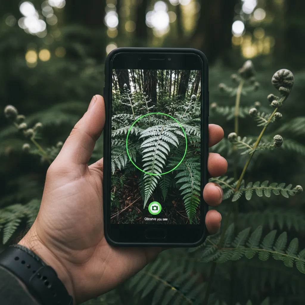
Participating is as simple as downloading the app and snapping a photo. However, to make your data scientifically valuable, follow these steps:
- Take Clear Photos: Ensure the subject is in focus. For plants, try to photograph the leaves, flowers, and bark.
- Record Location and Time: Modern smartphones do this automatically, but accuracy is crucial for mapping species distribution.
- Achieve Research Grade: An observation becomes “Research Grade” when it has a date, location, photo, and the community agrees on the identification. These records are often exported to the Global Biodiversity Information Facility (GBIF) for use by scientists worldwide.
This tool is particularly vital for biosecurity. Several new pest incursions in New Zealand, such as the myrtle rust fungus, have been tracked and managed thanks to early detections reported by citizen scientists on iNaturalist.
The Great Kererū Count: Monitoring Our Native Pigeon
The Great Kererū Count is New Zealand’s largest national citizen science project dedicated to a single species. The Kererū (Hemiphaga novaeseelandiae) is a keystone species, vital for the regeneration of native forests as they are the only birds large enough to disperse the seeds of large native trees like tawa, taraire, and karaka.
Why Count Kererū?
While Kererū are a common sight in many suburbs, their population trends need constant monitoring. They are vulnerable to predation by stoats and rats, as well as vehicle strikes. The annual count helps conservationists understand:
- Population Abundance: Is the population increasing, stable, or declining?
- Distribution: Are they moving back into urban areas where pest control is active?
- Health: Are the birds displaying signs of disease or malnutrition?
How to Participate
The count typically takes place over ten days in late spring. Participants are asked to count the number of Kererū they see at any one time (to avoid double counting the same bird). Even if you see no birds, submitting a “zero count” is scientifically important as it indicates where the birds are absent.
Marine Debris Surveys and Coastal Health
With over 15,000 kilometers of coastline, New Zealand’s marine environment is vast. Marine debris surveys, particularly those organized under the Litter Intelligence program led by Sustainable Coastlines, provide critical data on ocean pollution.
The Methodology of Litter Audits
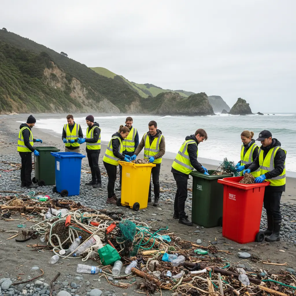
Unlike a standard beach cleanup, a citizen science litter audit follows a rigorous methodology to ensure data quality. This data is used by the Ministry for the Environment for national reporting.
- Select a Survey Area: A 100-meter stretch of beach is identified.
- Transect Cleaning: Volunteers collect all visible litter from the surface of the designated area.
- Categorization and Weighing: The debris is sorted into specific categories (e.g., hard plastic, soft plastic, glass, metal) and counted/weighed.
- Data Entry: Results are uploaded to a national database which tracks the density and type of litter over time.
This data has been instrumental in driving policy changes, such as the ban on single-use plastic bags, by providing undeniable evidence of the plastic types accumulating on New Zealand shores.
Bird Banding Reporting and Tracking
Bird banding involves placing a small metal or colored plastic ring on a bird’s leg. Each band has a unique code. This is a sophisticated method of tracking longevity, migration, and survival rates. While the banding itself requires a specialized permit and training, the reporting of banded birds is a crucial role for the general public.
How to Report a Banded Bird
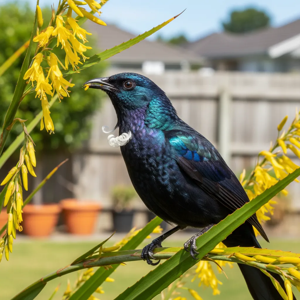
If you spot a bird with a band—common species include Dotterels, Kea, Tūī, and Godwits—you should report it to the Department of Conservation (DOC) National Bird Banding Office.
What to record:
- The Code: If you can read the numbers or letters on the metal band.
- Color Combination: Many birds have a specific combination of colored bands (e.g., Red over Blue on the left leg, Metal on the right leg).
- Location and Date: Precise GPS coordinates are best.
- Photo: A zoom photo showing the legs is incredibly helpful for verification.
Reporting these sightings helps researchers track the movement of endangered species like the Kea, providing insights into how they interact with human environments and where they face the highest risks.
The NZ Garden Bird Survey
Organized by Manaaki Whenua – Landcare Research, the NZ Garden Bird Survey is an annual event that takes place in winter.
The Pulse of the Environment
Birds are excellent indicators of environmental health. By spending just one hour observing birds in your garden, park, or school, you contribute to a snapshot of the health of our ecosystems. The survey looks for trends in both native species (like Fantails/Pīwakawaka and Bellbirds/Korimako) and introduced species (like House Sparrows and Mynas).
The data from this survey has highlighted the gradual return of native birds to urban Wellington, a direct result of the “Halo” effect from the Zealandia ecosanctuary and community trapping efforts.
Pest Monitoring and Trap.NZ
New Zealand has an ambitious goal to be Predator Free by 2050. Citizen science plays a massive role in this through pest monitoring and trapping data.
Using Trap.NZ
Trap.NZ is the leading platform for community trapping groups. While primarily a management tool, it aggregates massive amounts of citizen-collected data regarding pest density and trap efficacy.
Volunteers can participate by:
- Monitoring Chew Cards: Placing wax tags or chew cards in the bush to identify which predators are present based on bite marks.
- Reporting Catches: Logging catches of rats, stoats, and possums.
This data allows conservationists to visualize “heat maps” of predator activity, ensuring resources are deployed to the areas where biodiversity is most at risk.
How to Start Your Citizen Science Journey
Getting involved in nz citizen science projects requires minimal equipment but a high degree of enthusiasm. Here is a quick guide to getting started:
- Choose Your Niche: Are you interested in marine life, birds, plants, or pest control?
- Download the Apps: Install iNaturalist, the Great Kererū Count app, or register on the Trap.NZ website.
- Join a Local Group: Many projects are coordinated by local conservation trusts. Websites like “Conservation Volunteers NZ” or the DOC website list local opportunities.
- Prioritize Safety: New Zealand’s weather is changeable. Always tell someone where you are going, carry appropriate clothing, and respect private property boundaries.
- Follow Ethical Guidelines: Observe wildlife from a distance. Do not disturb nesting birds or damage vegetation to get a better photo.
Frequently Asked Questions
What is the most popular citizen science project in New Zealand?
iNaturalist NZ is widely considered the most popular and accessible project, with thousands of daily observations uploaded by users across the country covering all types of flora and fauna.
Do I need a science degree to participate in these projects?
No, you do not need a degree. Most nz citizen science projects are designed for the general public. Projects like the Garden Bird Survey or Marine Debris surveys provide simple guides and training materials to ensure anyone can contribute valid data.
How do I report a bird band in NZ?
You can report bird bands directly to the Department of Conservation (DOC) via their online Bird Banding Office form. You will need to provide the band combination, location, date, and ideally a photograph.
When does the Great Kererū Count take place?
The Great Kererū Count is an annual event that typically takes place over 10 days in late September or early October. Dates can vary slightly each year, so it is best to check the official website.
Is the data collected by citizens actually used by scientists?
Yes, absolutely. Data from platforms like iNaturalist and Litter Intelligence is frequently used in peer-reviewed scientific papers, government environmental reports, and by local councils for biodiversity planning.
Can children participate in citizen science?
Yes, many projects are excellent for children and schools. The NZ Garden Bird Survey and Marine Meter Squared are specifically designed with educational resources to help students learn about nature while contributing to science.