The Hauraki Gulf Marine Park is New Zealand’s first national park of the sea, encompassing 1.2 million hectares of ocean, islands, and catchments surrounding Auckland and the Coromandel Peninsula. Established in 2000, it protects a unique ecosystem rich in biodiversity, including rare seabirds and resident marine mammals, balancing conservation with recreational and economic activities.
The Extent and Geography of the Marine Park
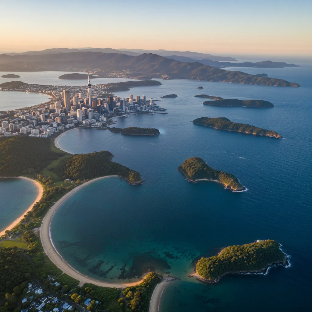
The Hauraki Gulf Marine Park is a colossal entity, not just in terms of its physical size but in its ecological and cultural significance to New Zealand. Unlike traditional land-based national parks, the Hauraki Gulf Marine Park (HGMP) integrates the sea, the islands, and the catchment areas that feed into the gulf. This holistic approach recognizes that land-use activities directly impact marine health.
Covering an area of approximately 1.2 million hectares (12,000 square kilometers), the park extends from Te Arai in the north down to Waihi Beach in the south. It encompasses the Waitematā Harbour, the Firth of Thames, and the eastern coastline of the Coromandel Peninsula. This vast expanse is more than 20 times the size of Lake Taupō.
Crucially, the park’s jurisdiction includes the land catchment. This means that streams and rivers flowing from the Hunua and Waitākere Ranges, the Hauraki Plains, and the Coromandel Ranges are considered part of the park’s ecosystem. The health of the marine environment is inextricably linked to the sediment and nutrients washing off this land, making the “Ki uta ki tai” (mountains to sea) management approach essential.
A Unique Legislative Framework
The park was established under the Hauraki Gulf Marine Park Act 2000. This legislation is unique in New Zealand law because it elevates the protection of the environment above other interests in cases of conflict, although in practice, balancing commercial fishing, shipping, and conservation has proven challenging. The Act recognizes the Gulf as a matter of national significance, acknowledging the relationship of the tangata whenua (indigenous people) with the environment.
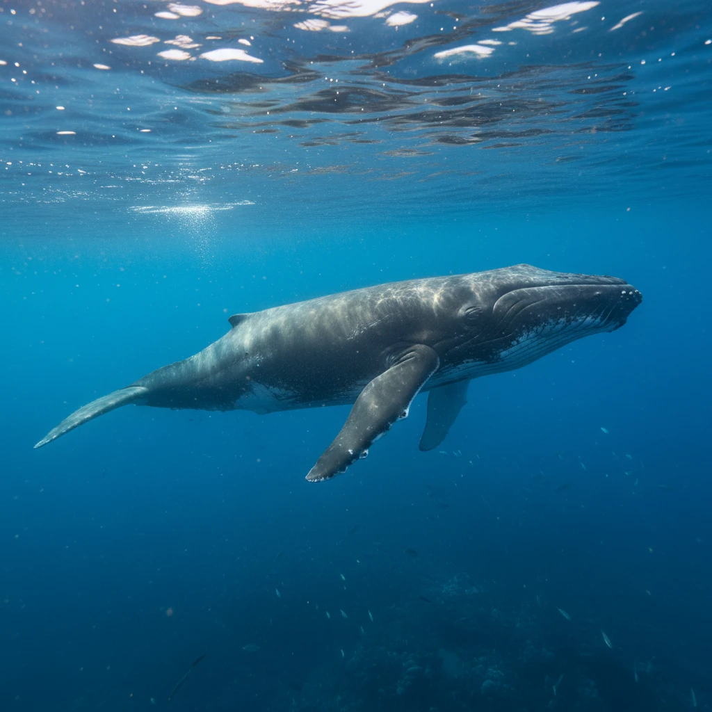
The Resident Bryde’s Whale Population
One of the most biologically significant features of the Hauraki Gulf Marine Park is its population of Bryde’s Whales (pronounced “broo-duss”). While most baleen whales are migratory, travelling thousands of kilometers between feeding and breeding grounds, the Bryde’s Whales of the Hauraki Gulf are unique: they are residents.
Why is this population significant?
- Year-Round Presence: This is one of the few places in the world where a resident population of these whales can be found year-round close to a major metropolitan city.
- Critically Endangered Status: The local population is small, estimated to be fewer than 200 individuals, making them nationally critical.
- Surface Feeding Behaviour: These whales are known for their acrobatic feeding, often lunging through boil-ups of pilchards and anchovies alongside dolphins and gannets.
Conservation Success: The Transit Protocol
For years, the primary threat to these whales was ship strikes from large commercial vessels entering the Port of Auckland. In a groundbreaking collaborative effort involving the shipping industry, scientists, and the Department of Conservation, a voluntary transit protocol was introduced. Large vessels now slow down to 10 knots when transiting the Gulf. Since the implementation of this protocol, the mortality rate of Bryde’s Whales due to ship strikes has dropped dramatically, serving as a global model for marine conservation.
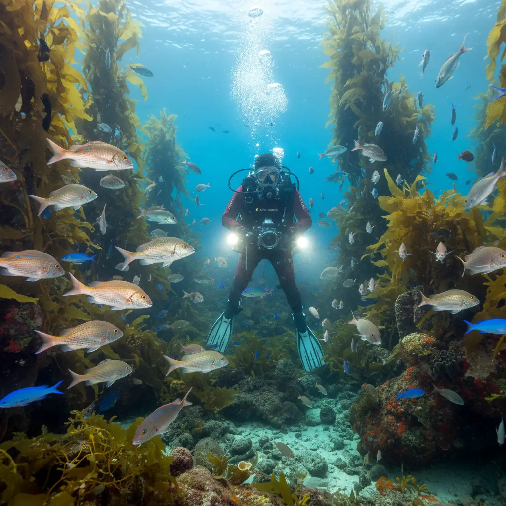
Beyond Whales: A Hotspot of Biodiversity
While the Bryde’s Whale is the flagship species, the Hauraki Gulf Marine Park teems with other life. It is a seabird capital of the world, hosting roughly 20% of the world’s seabird species.
The waters are home to large pods of Common Dolphins and Bottlenose Dolphins. Orca (Killer Whales) are frequent visitors, entering the harbours to hunt stingrays in the shallows. The Gulf also supports Hammerhead Sharks, Manta Rays, and a recovering population of Australasian Snapper and Crayfish (Rock Lobster), although stocks remain under pressure.
Key Islands Within the Park
The park is studded with over 50 islands, each with its own character and ecological role. These islands serve as “lifeboats” for New Zealand’s endangered flora and fauna.
Rangitoto Island
The youngest volcano in the Auckland field, emerging from the sea only 600 years ago. It is an iconic landmark with a unique ecosystem of pohutukawa forests growing directly out of lava fields. It is pest-free and home to native birds like the Saddleback (Tīeke).
Tiritiri Matangi
Perhaps the most successful open scientific reserve in the country. Through massive volunteer effort, this island was replanted with native bush and is now a sanctuary for the Takahē, Kōkako, and Tuatara. It serves as a vital educational hub for eco-tourism.
Great Barrier Island (Aotea)
The largest island in the Gulf, Aotea acts as a shield against the Pacific Ocean. It is an International Dark Sky Sanctuary and retains a rugged, untouched wilderness feel. It holds significant populations of Chevron Skinks and Black Petrels.
Waiheke Island
The most populated island, known for its vineyards and beaches. While developed, it plays a role in the park through community-led conservation projects and marine reserve proposals aimed at protecting the coastal fringes.
The Sea Change (Tai Timu Tai Pari) Plan
Despite its protected status, the Hauraki Gulf has suffered from environmental degradation. Overfishing, sedimentation from land development, and nutrient runoff have led to a decline in marine health. In response, the Sea Change – Tai Timu Tai Pari marine spatial plan was developed.
What is the Sea Change Plan?
Released in 2017, Sea Change is a collaborative non-statutory plan designed to reverse the decline of the Gulf. It was created by a stakeholder working group comprising Mana Whenua, environmentalists, and commercial and recreational fishers.
Key Objectives of Sea Change:
- Phasing out destructive fishing methods: The plan calls for the removal of bottom trawling and Danish seining from the Gulf to protect the seafloor and benthic habitats.
- Creating Marine Protected Areas (MPAs): It proposes new marine reserves and protection areas to allow fish stocks and ecosystems to recover.
- Restoring Mussel Reefs: Historically, the Gulf was carpeted in mussel beds which filtered the water. Most were dredged out in the last century. Restoring these reefs is critical for water quality and fish nurseries.
- Sediment Control: Implementing stricter land management rules to stop mud from choking the marine environment.
Recent government announcements regarding the Hauraki Gulf / Tīkapa Moana Marine Protection Bill aim to bring many of these recommendations into law, significantly increasing the percentage of the Gulf under high protection.
Current Threats and Conservation Efforts
Understanding the threats is the first step toward effective conservation. The Hauraki Gulf faces a “triple whammy” of pressures.
Sedimentation
Often cited as the number one enemy of the Gulf, fine sediment washes off construction sites, forestry blocks, and farms. It settles on the seafloor, smothering marine life and reducing light penetration, which kills off kelp forests.
Fishing Pressure
While recreational fishing is a beloved pastime, the cumulative effect of thousands of boats, alongside commercial extraction, has depleted stocks. The depletion of large predators (like big Snapper and Crayfish) creates an imbalance, leading to “kina barrens” where sea urchins strip the reef of kelp.
Invasive Species
Marine pests like the Mediterranean fanworm and invasive sea squirts threaten to outcompete native species. Biosecurity measures are strictly enforced for vessels visiting the pest-free islands.
Eco-Tourism and Responsible Recreation
The Hauraki Gulf Marine Park is a major asset for the New Zealand economy, particularly through eco-tourism. Operators offer whale and dolphin watching safaris that adhere to strict Department of Conservation guidelines.
How to Visit Responsibly:
- Check, Clean, Close: Before visiting pest-free islands, ensure gear is free of seeds, soil, and pests.
- Follow Fishing Rules: Adhere to bag limits and size limits. Better yet, practice catch and release.
- Keep Your Distance: When encountering marine mammals, keep the boat in neutral and do not approach closer than regulations allow (usually 50m for whales, 300m if there are calves).
The future of the Hauraki Gulf Marine Park depends on the collective action of government, iwi, and the public. Through the implementation of the Sea Change plan and a shift toward regenerative tourism, there is hope that the Mauri (life force) of the Gulf can be restored.
People Also Ask
Is fishing allowed in the Hauraki Gulf Marine Park?
Yes, fishing is allowed in most areas of the park, but it is subject to strict regulations regarding size, bag limits, and seasonal closures. However, there are specific Marine Reserves (like Goat Island and Tawharanui) where all fishing and gathering is strictly prohibited.
How big is the Hauraki Gulf Marine Park?
The park covers an expansive area of 1.2 million hectares (approximately 12,000 square kilometers). It includes the ocean, the coastline, and the land catchment areas that drain into the Gulf.
Can you see whales in the Hauraki Gulf?
Yes, the Hauraki Gulf is one of the best places in New Zealand to see whales. It is home to a resident population of Bryde’s Whales and is frequently visited by Orca (Killer Whales) and occasionally Humpback Whales during their migration.
What are the main islands in the Hauraki Gulf Marine Park?
There are over 50 islands in the park. The most notable include Waiheke Island (populated), Great Barrier Island (Aotea), Rangitoto Island (volcanic), Kawau Island, and the pest-free sanctuary of Tiritiri Matangi.
What is the Sea Change plan?
Sea Change (Tai Timu Tai Pari) is a marine spatial plan developed to address the environmental decline of the Gulf. It recommends phasing out bottom trawling, creating more marine reserves, and improving land management to reduce sediment runoff.
Why is the Hauraki Gulf water sometimes green?
The water color can be affected by phytoplankton blooms (algae) which are a food source for marine life, or by sediment runoff after heavy rains. Sediment is a major conservation issue as it reduces water clarity and smothers marine habitats.