The Wairarapa Dark Sky Reserve map encompasses a protected area of 3,665 square kilometers, covering the entirety of the South Wairarapa and Carterton districts. Officially accredited as an International Dark Sky Reserve, this zone enforces strict outdoor lighting ordinances to preserve the pristine quality of the night sky, extending from the Tararua Forest Park to the rugged southern coastline.
New Zealand has long been celebrated for its breathtaking landscapes, but a new frontier of conservation has turned the world’s eyes upward. The Wairarapa Dark Sky Reserve (WDSR) represents a monumental achievement in environmental protection and eco-tourism. Situated just an hour’s drive from the bustling capital of Wellington, this region offers some of the most accessible and darkest skies in the world. For astronomers, photographers, and nature enthusiasts, understanding the Wairarapa dark sky reserve map is the first step to unlocking a celestial treasure trove.
Navigating the Wairarapa Dark Sky Reserve Map
To truly appreciate the scale of this achievement, one must understand the geography defined by the Wairarapa dark sky reserve map. Unlike isolated observatories located on remote mountain peaks, this reserve is unique because it overlays a living, breathing community. It includes thriving towns, expansive vineyards, and pastoral farmland, proving that dark sky conservation can coexist with modern habitation.
The map is geographically distinct, bounded by natural barriers that help shield the region from light pollution. To the west, the Remutaka and Tararua Ranges act as a formidable wall, blocking the majority of the light glow emitting from the Wellington metropolitan area and the Hutt Valley. To the east and south, the reserve meets the Pacific Ocean, ensuring an endless horizon of darkness free from offshore light sources.

Core Zones vs. Peripheral Areas
Within the reserve map, the darkness levels vary slightly depending on proximity to the town centers of Martinborough, Featherston, Greytown, and Carterton. However, the designation requires that even these urban centers adhere to strict measurements of sky brightness. The “core” of the reserve is often considered the Aorangi Forest Park and the coastal stretches where artificial light is virtually non-existent. In these areas, the sky reaches a darkness of 21.7 to 22.0 magnitudes per square arcsecond—near the theoretical limit of total darkness on Earth.
When studying the map for a visit, look for the rural roads connecting the townships. These corridors, often unlit and flanked by farmland, serve as excellent improvised viewing platforms where one can pull over safely and witness the Milky Way stretching from horizon to horizon.
Prime Stargazing Locations: Martinborough and Carterton
While the entire region under the map falls under the reserve status, specific locations offer superior viewing experiences due to elevation, public access, and lack of immediate streetlights.
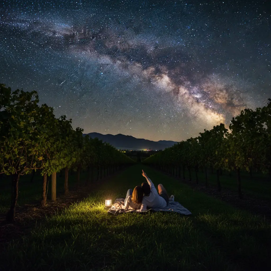
Martinborough: Vineyards Under the Stars
Martinborough is world-renowned for its Pinot Noir, but it is rapidly gaining fame for its night sky. The town’s layout, centered around a quaint square, allows for a quick escape to darker rural outskirts. Many local vineyards have embraced the dark sky ethos, offering accommodation where guests can stargaze directly from their vines.
Top Martinborough Spots:
- Ruakokoputuna Road: Heading south towards the coast, this road leads into deep valleys where the hills block out even the faint glow of the town.
- Lake Ferry & Cape Palliser: Located at the southernmost tip of the map, these coastal areas offer dramatic foregrounds for stargazing. The Cape Palliser Lighthouse provides a stunning silhouette against the galactic core, although visitors should be mindful of the coastal winds.
Carterton: The Heart of the Dark Sky
Carterton promotes itself as the gateway to the Tararua Ranges. The district’s commitment to the reserve is evident in its street lighting upgrades. For the best views here, you want to head toward the foothills.
Top Carterton Spots:
- Fensham Reserve: A short drive from the town center, this nature reserve offers a dark, quiet environment perfect for setting up a telescope.
- Flat Point: On the eastern coast of the Carterton district, Flat Point is a remote beach community. The drive there is an adventure in itself, traversing winding roads that offer spectacular, unobstructed views of the southern celestial pole.
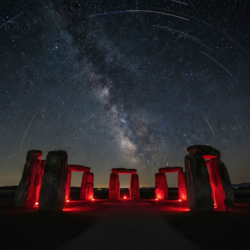
Stonehenge Aotearoa: A Window to the Past
No discussion of the Wairarapa dark sky reserve map is complete without mentioning its crown jewel of astronomical education: Stonehenge Aotearoa. Located in the Carterton district, this open-air astronomical observatory is a modern adaptation of the ancient Stonehenge in England, but built specifically for the latitude of New Zealand.
What makes Stonehenge Aotearoa critical to the reserve is its function as an educational hub. It connects the physical map of the land with the celestial map of the sky. The henge is designed to teach visitors how early cultures, including Māori navigators, utilized the stars for wayfinding and seasonal tracking.
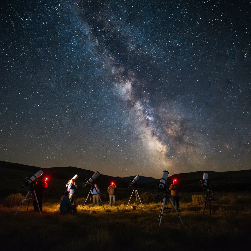
The Star Safari Experience
Operated nearby, Star Safari offers guided telescope tours. This is often the best entry point for novices. Using high-powered 16-inch telescopes, guides can show you deep-sky objects that are invisible to the naked eye, such as the Jewel Box Cluster, the Tarantula Nebula, and the rings of Saturn. Their location is strategically placed within the reserve to maximize the dark sky potential while remaining accessible from the main highways.
Community Lighting Ordinances and Conservation
How does a region achieve and maintain “Dark Sky” status? The secret lies in the rigor of the community lighting ordinances. The Wairarapa Dark Sky Association worked tirelessly with the South Wairarapa and Carterton District Councils to implement plan changes that control light pollution. This doesn’t mean turning off all the lights; it means lighting smarter.
The Rules of the Reserve
To comply with the International Dark-Sky Association (IDA) standards, the region has adopted specific rules that affect both public and private properties within the map boundaries:
- Shielding: All outdoor lights must be fully shielded, meaning the light fixture directs light downward, not upward into the sky or sideways into a neighbor’s window.
- Color Temperature: The reserve mandates the use of warm-colored LEDs (3000 Kelvin or lower). Blue-rich white light is the most damaging to the night sky (creating “sky glow”) and is harmful to wildlife circadian rhythms.
- Timing and Intensity: Streetlights in the districts are often dimmed during the late hours of the night when traffic is minimal, further reducing the overall light footprint.
These ordinances are vital for the local ecology. The Wairarapa is home to native nocturnal species, such as the Morepork (Ruru) and various geckos, whose hunting and breeding cycles rely on true darkness. By adhering to the reserve map’s guidelines, the community protects these species while saving energy.
Events, Star Parties, and Astrotourism
The Wairarapa Dark Sky Reserve is not a static entity; it is a hub of activity. Throughout the year, the region hosts events that celebrate the night sky, drawing visitors from across New Zealand and abroad.
Matariki Celebrations
Matariki, the Māori New Year, is marked by the rising of the Pleiades star cluster. Given the cultural significance of astronomy in Aotearoa, the Wairarapa hosts extensive Matariki festivals. These events often combine traditional storytelling, music, and food with guided stargazing sessions, bridging the gap between cultural heritage and modern astronomy.
Wairarapa Dark Sky Festival
Periodic festivals and “star parties” are organized to encourage locals and tourists to turn off their lights and look up. These events often feature guest lectures from astrophysicists, astrophotography workshops, and public telescope viewings. Checking the Wairarapa Dark Sky Association’s calendar is essential for anyone planning a trip, as these events provide access to expert knowledge and high-end equipment.
Astrophotography Guide for the Wairarapa
For photographers, the Wairarapa dark sky reserve map is essentially a treasure map. However, capturing the perfect shot requires preparation. The region is known for its strong winds, particularly around the equinoxes, so a sturdy tripod is non-negotiable.
Best Times to Shoot
Winter (June – August): This is the prime season for viewing the galactic core of the Milky Way. The core rises early in the evening and stretches directly overhead. The nights are long and crisp, providing the clearest air, though temperatures can drop below freezing.
Summer (December – February): While the galactic core is less visible, the summer sky offers the Orion constellation (which appears upside down in the Southern Hemisphere compared to the North) and the Large and Small Magellanic Clouds—dwarf galaxies orbiting the Milky Way that look like detached pieces of the Milky Way.
Composition Ideas
Utilize the unique Wairarapa landscape. The pinnacles of the Putangirua Pinnacles Scenic Reserve (famous as a “Lord of the Rings” filming location) offer eerie, ancient rock formations that look spectacular when backlit by starlight. Alternatively, the historic colonial architecture of Greytown or the Cape Palliser Lighthouse provides excellent foreground interest to give scale to the infinite cosmos above.
People Also Ask
Where are the boundaries of the Wairarapa Dark Sky Reserve?
The Wairarapa Dark Sky Reserve boundaries strictly follow the district lines of the South Wairarapa District and the Carterton District. This area spans approximately 3,665 square kilometers, bordered by the Tararua and Remutaka Ranges to the west and the Pacific Ocean to the south and east.
Can you see the Southern Lights from Wairarapa?
Yes, it is possible to see the Southern Lights (Aurora Australis) from the Wairarapa, particularly from the southern coastal areas like Cape Palliser and Lake Ferry. However, sightings depend on strong solar activity and clear, moonless nights. The reserve’s low light pollution significantly improves the chances of capturing the faint glow on the southern horizon.
Is Masterton part of the Dark Sky Reserve?
Currently, Masterton is not officially part of the certified International Dark Sky Reserve, which covers South Wairarapa and Carterton. However, there are ongoing discussions and efforts to expand the dark sky protections to include the Masterton district in the future to create a region-wide dark sky zone.
What is the best time of year to visit Wairarapa for stargazing?
Winter (June to August) is generally considered the best time for stargazing in Wairarapa because the galactic core of the Milky Way is most visible, and the nights are longest. However, the cold weather requires warm clothing. Autumn and Spring also offer excellent viewing conditions with milder temperatures.
Do I need a telescope to enjoy the Wairarapa Dark Sky Reserve?
No, a telescope is not necessary. The skies in the reserve are so dark (Bortle Class 2 or 3 in many areas) that the naked eye can see thousands of stars, the Milky Way, and the Magellanic Clouds. However, a pair of binoculars can greatly enhance the experience by revealing star clusters and nebulae.
Are there guided dark sky tours available in Wairarapa?
Yes, there are several operators. Star Safari in Carterton offers guided telescope tours, and Stonehenge Aotearoa provides guided tours focusing on archaeoastronomy. Additionally, Under the Stars offers nomadic astronomy tours that can come to your accommodation in the Martinborough area.